| Year | Arab | Total |
|---|---|---|
| 1931 | 388 | |
| 1944/45 | 510 | 510 |
| Year | Arab | Public | Total |
|---|---|---|---|
| 1944/45 | 2758 | 73 | 2831 |
| Use | Arab | Public | Total | ||||||||||||
|---|---|---|---|---|---|---|---|---|---|---|---|---|---|---|---|
|
80 | 73 | 153 (5%) | ||||||||||||
|
2678 | 2678 (95%) |
The village stood on a low rise overlooking wide areas on the south and west, and was linked by a short paved road (built by the volunteer labor of the villagers) to the Ramla-Jerusalem highway. Wadi al-Barriyya passed through the eastern edge of the village. In the late nineteenth century, aI-Barriyya was described as a small hamlet built of adobe bricks and surrounded by cultivated land. The village plan was rectangular, generally extending in an east-west direction; as the village grew, new houses were built towards the south and southeast. (Fruit orchards and the village's threshing grounds obstructed any possible expansion to the north, while Wadi aI-Barriyya hindered growth towards the east.) Most of the residents of al-Barriyya were Muslims and worshipped in a small mosque. The village also had an elementary school for boys, which had forty-eight students and one teacher at the time of its founding in 1943. The villagers relied upon rain water, collected in cisterns, and the water resources of nearby villages for their domestic water needs.
The village economy was based mainly on beekeeping and on rainfed agriculture. The British Royal Commission that visited the village in 1936 reported that al-Barriyya was one of the pioneering villages in the adoption of beekeeping. Revenues from this activity were estimated at 1,000 Palestinian pounds in 1936. Cultivated crops included grain, watermelons, and vegetables. In 1944/45 a total of 2,627 dunums was allocated to cereals; 51 dunums were irrigated or used for orchards. Some villagers also worked in animal husbandry while a few others were migrant laborers in nearby cities.
Israeli historian Benny Morris indicates that al-Barriyya was attacked and depopulated between 10 and 13 July 1948. This apparently took place during Operation Dani (see Abu aI-Fadl, aI-Ramla sub-disctrict). But the History of the War of Independence states that the village was already in Israeli hands at the beginning of Operation Dani, on 9-10 July. The plan of that operation indicated that al-Barriyya would be the launching point for an Israeli unit that would encircle Lydda and Ramla. Under those circumstances, the village may have been occupied in the course of Operation Barak (see al-Batani al-Gharbi, Gaza sub-disctrict), the offensive launched in the Ramla area during the month of May.
Whatever the date of occupation, it is clear that al-Barriyya was firmly in Israeli hands by September. Morris relates that Israeli prime minister Ben-Gurion applied to the cabinet for permission to destroy the village in mid-September. He does not mention whether permission was granted, but that same month the village was reported to have been renamed Barriya Bet and settled with Jewish immigrants. On 21 September the settlers reportedly abandoned the site for 'lack of motivation,' preferring 'the seeming comforts of town.'
Currently there are two Israeli settlements on village lands: 'Azarya (141144), founded in 1949, and Beyt Chashmonay (142144), founded in 1972. Kefar Shemu'el (144144), founded in 1950 on the lands of the destroyed village of 'Innaba (Ramla sub-disctrict), is about 4 km east of the site.
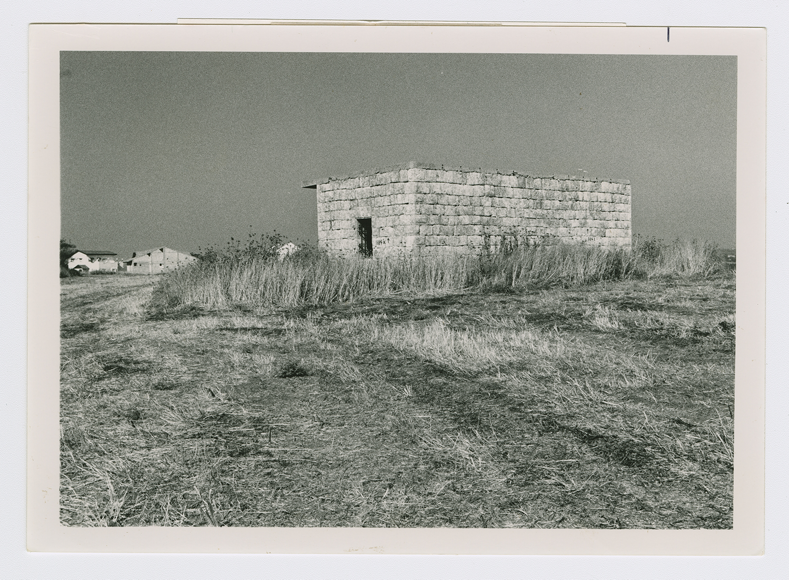
The village site is mostly cleared and has been levelled except for one remaining stone house and fragments of the walls of two concrete houses with steel bars protruding from them (see photos).
Related Content
Violence
End of First Truce: Israeli Operations An-Far, Dani and Qedem
1948
8 July 1948 - 17 July 1948


